
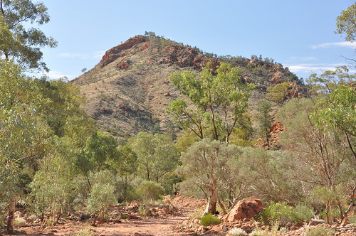
Stop one: Mount Gee.
Welcome to the VRTT - the Virtual RidgeTop Tour. This tour focuses specifically on those areas of this section of Arkaroola targetted by the mining industry - and made available to them by the state government and its 'Seeking a Balance' (SaB) mining access plan.
Other tours of the industry's target areas will follow - but why not start with one of the most famous 4WD treks in Australia?
(For the complete selection of images see the ridgetop tour set on flickr.)
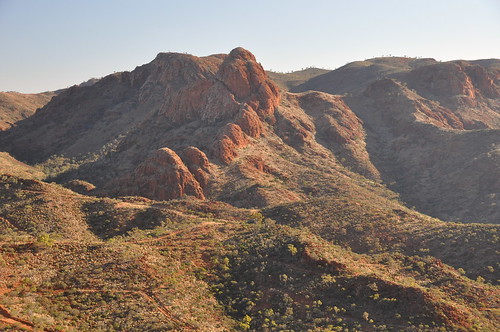
First stop - see above - Mount Gee, the crystal mountain. This is how it looks as you approach it along the Ridgetop Track.
Mount Gee has been the major target for Marathon Resources' recent exploration drilling program, and has been extensively investigated by previous miners. While Seeking a Balance has placed the already heavily drilled upper sections of Mount Gee into the relatively restrictive Access Zone 2a, this photo is taken from an area assigned to Access Zone 3 - 'standard mining regulations only' apply (that is, no extra conservation protections have been assigned here in the heart of the Arkaroola Wilderness Sanctuary. This designation is given to the bulk of this central portion of Arkaroola Sanctuary.)
(You can follow our progress on the VRTT and the state government's proposed mining access zoning in better detail here. A detailed discussion of SaB's proposed zoning can be found here.)
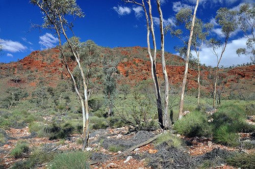
Stop two: Mount Painter.
The upper slopes of this extinct mud-volcano are also assigned to 'no high impact' exploration activity Access Zone 2a. However, non-intrusive ground-sampling and aerial exploration is still permitted, and 'infrastructure' (undefined) may possibly be installed here. Mining companies may also hope to tunnel in underneath it from adjacent access zones that allow it (and simultaneously saving themselves $millions in vertical drilling in the process! See later discussion for Access Zone 2b.)

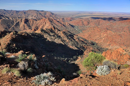
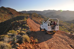
Stop three: the Split Rock lookout.
Here at the lookout itself we have reached a small area where mining is not actually permitted(!) (It's perhaps worth noting that several - unkind, surely? - expert opinions offered to the Seeking a Balance consultation observed that the area immediately around Split Rock has been previously explored and found to contain no minerals worth obtaining! Perhaps it's just a coincidence!?)
However, we can see plenty of countryside the miners can hope to target from here, including Mount Painter, as seen here, and as discussed at stop two immediately above.
And if we swing our view to the west we can see Mount Gee again, and the valley lying to its east between it and Mount Painter. The small basin lying immediately below Mount Gee - here obscured by a low ridgeline - was the site of the illegal dumping of 22 800 bags of waste, some of it radioactive, by Marathon Resources.
This basin is assigned to Access Zone 2b, which differs from Zone 2a in that it allows for drilling. The two zones share a proviso allowing for the installation of 'infrastructure' (still undefined), and would-be drillers and infrastructuralists must obtain the Department for Environment and Heritage's approval before proceeding. (Given that SaB itself and its zoning is a joint project of the DEH and Primary Industries SA [PIRSA] Minerals conservationists may not want to get too excited about this!)
In fact, if we zoom in...

...we can see extensive exploration scarring on the flanks of Mount Gee above this basin. And even some of Marathon Resources' polytanks! (Click the image to see details)
All this apparently constitutes 'rehabilitation' in PIRSA's eyes - you'll forgive me if, as a professional revegetator, I fail to subscribe to their 'optimistic' theories about what can actually be done to genuinely rehabilitate such wild semi-arid areas. Particularly given the recent persistence of drought conditions! As we'll see, the area between Mount Gee and Siller's Lookout - the outward-bound terminus of both the real RTT and this virtual version - is extensively scarred by exploration tracks old and new.
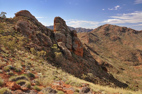
Here we see Split Rock itself. It's a great spot and worthy of its Access Zone 1 full protection - sadly the East Painter Gorge, which you can see falling away below it, is not so lucky.
In fact, like the spectacular Yudnamutana Gorge (we'll see it from Siller's Lookout as we travel on, and a separate virtual tour of it is pending), one side of East Painter (short tour also pending) is afforded some - relative - protection (in this case Zone 2b with its DEH approval for drilling), while the other is left in Access Zone 3 - 'standard exploration and mining access'!
The East Painter and Yudnamutana Gorges also happen to be the most viable access routes from the core of the sanctuary - where the bulk of the currently-claimed uranium deposits are located - to the adjacent plains, where any processing facilities would be located.
Moving along...
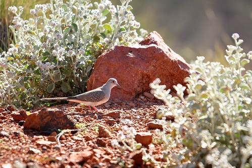
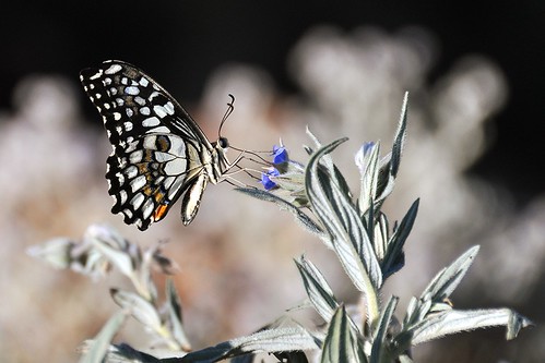
...we pause to admire some local wildlife (in this case a Diamond Dove)...
...and pass the Armchair on our left. Like its neighbouring peaks, the Armchair itself is in Access Zone 2a, but all the country you can see in the foreground here is assigned to Access Zone 2b - drilling allowed with the DEH's approval.
'Infrastructure' can conceivably be installed anywhere in this region. I'll leave it to you to imagine this!
You can see an extensive network of exploration scarring from access tracks in the foreground here, another reminder of how sensitive these semi-arid regions actually are. (Click on the image for a larger version and more detail.)
We will come back to the Armchair on the return journey.
Moving on we finally reach...
Stop three: Siller's Lookout
Now we are back firmly in Access Zone 3 - 'standard exploration and mining access'. No specific conservation provisions apply to Siller's Lookout itself and the bulk of the surrounding countryside you can see here. And this despite the Environment Minister of the time saying, while launching SaB -
I think what people need to rest assured about is that when they think about Arkaroola and they think about the iconic spots, the things that they have in their minds will be now [be] protected
(See Not a great Lookout for Siller's for more on this issue.)
Now we're directly overlooking the Yudnamutana Gorge. The state government has decreed, in its wisdom, that almost all of the land on the southern and eastern (right-hand side here) of the gorge is assigned to Access Zone 3 - no additional protections - while the northern and western side is allocated to either Access Zones 2a or 2b.
Could you see this as a view overlooking a haulage route, or the right-of-way for a slurry pipeline? With a large processing facility and extensive leach dams out on the plains near the mouth of the gorge?
Or perhaps we might even see the mouth of an access tunnel, and trucks continuously entering and leaving the decline? Sure, Marathon sometimes say they intend to tunnel in from the plains and mine underground, but even that will require extensive access tracks and ventilation and emergency access shafts, and somehow in late 2009 online investment gurus Fat Prophets had formed the impression they're still looking to implement open cuts! (See It's the Pits!)
And SaB is a document that supposedly sets up access regulations for all mining operations in the far-northern Ranges, not just Marathon's. These 'Mining Access Zone' designations render this area perpetually vulnerable!

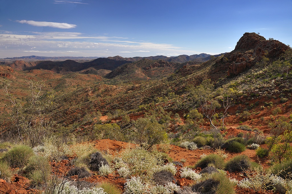
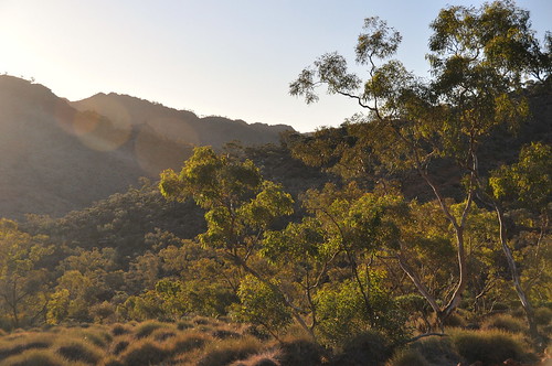
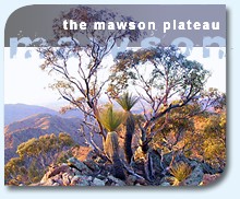
Turn north and look out towards over the upper Yudnamutana Gorge and the Mawson Plateau. The Mawson Plateau - the dark line of very high country on the horizon - is assigned to Access Zone 1; that is, No Access! Hoorah! (Some people also unkindly insist it's not prospective, either! But no matter...)
Other than that what you can see is a mosaic of SaB Zones 3 (everything on this side of the deep Yudnamutana Gorge, which lies at the rear of the ridge in the middle-ground) and 2a (everything beyond that and up to the plateau.)
So it's anything goes (PIRSA variant) in the foreground and perhaps parking the infrastructure to support it at the rear! This to be inserted into one of the most spectacular views in South Australia; seriously, you could not make this stuff up!

So we pause a little longer at the lookout to take in the sights and wonder how anyone could see this as a great spot for a mine. And then retrace our route...
...pausing to absorb the beauty of a hanging valley of mallee and spinifex that is the home of flitting grasswrens (and located in drilling-accessible Zone 2b)...

...and return to the Armchair (a fitting place to end any trip, surely?!)
Again, note the exploration tracks on the ridge opposite. The country you can see here is drilling-accessible Zone 2b in the foreground while the Armchair itself at rear is Zone 2a, and hence can theoretically be mined underneath from the surrounding country. Not to mention the potential for installing 'infrastructure'; whatever that might be!
That concludes our short tour. Thanks for riding the Desktop Toyota! Tell your friends!
(Don't forget you can see the full set of images on flickr!)

![link to the u[n]sa homepage](http://users.chariot.net.au/~greenh/blog/unknownsa_ublog-text.gif)

![link to the u[n]sa features page](http://users.chariot.net.au/~greenh/blog/features_ublog-text.gif)
![link to the u[n]sa kangaroo island feature image pages](http://farm2.static.flickr.com/1306/1187313059_93fdefd86b_o.jpg)
![link to the u[n]sa katarapko creek / murray river np feature image pages](http://farm2.static.flickr.com/1435/1181073355_b5c45f799d_o.jpg)


!['constellation' - wild country [national] set on flickr](http://farm1.static.flickr.com/155/415123844_3e6da621e5_s.jpg)

!['the bay serene' - the wild west [coast] set on flickr](http://farm1.static.flickr.com/121/312226516_606ac35455_s.jpg)


![u[n]sa journal - thanks for your time!](http://users.chariot.net.au/~greenh/blog/journal_ublog-text.gif "u[n]sa journal -thanks for your time!")
Well Bill, without concerted action, beautiful Arkaroola may become another mining wasteland. Certainly the SA Government will be seen as complicit in much of the destruction, while lunching with the mining lobby. But why should they worry, they may be gone soon. Its a pity humans cant seem to live without our toys and much of these minerals will be used to make those toys. But I am upbeat because when they have finished with our carbon saturated Atmosphere and we have turned our toys into landfill for the holes in Arkaroola, they will seek other homelands to waste for us all and we can relax for the first time since we came down from the trees. Perhaps selling Coke out of solar powered refrigerators to refugees, from those other wasted homelands. I am angry hooah! yes, I am angry at myself for my complicity in such a forsaken and avoidable destiny.
ReplyDeleteGuy